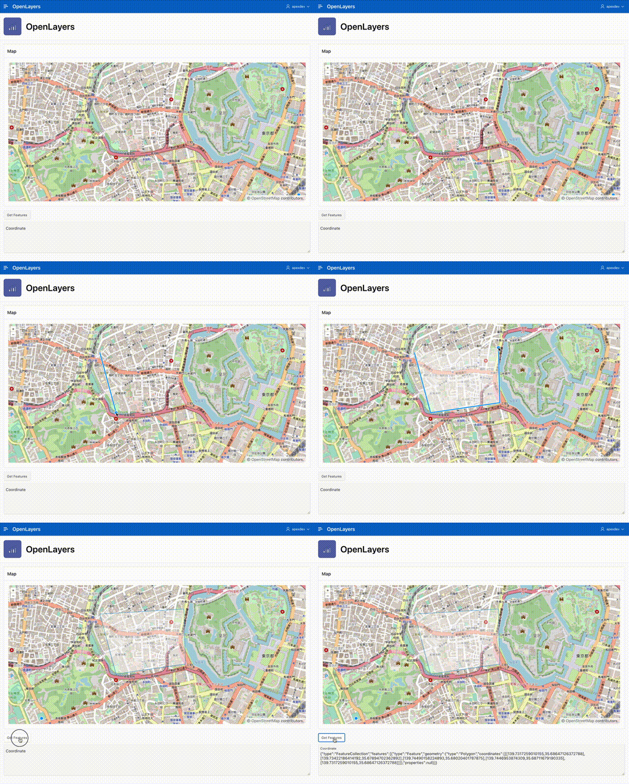
折角なので以前の記事に続き、OpenLayersの部分も試してみました。
Drawing objects on maps in Oracle APEX - MapLibre vs OpenLayershttps://pretius.com/blog/maplibre-vs-openlayers/
空のアプリケーションを作成したところから始めます。
静的コンテンツのリージョンを作成します。識別のタイトルはMapとします。
ソースのHTMLコードは以下です。
<div id="map"></div>
JavaScriptのファイルURLは以下になります。OpenLayersのサイトより、最新のバージョンを確認しましょう。
https://cdn.jsdelivr.net/npm/ol@v7.2.2/dist/ol.js
ファンクションおよびグローバル変数の宣言に以下を記述します。
This file contains bidirectional Unicode text that may be interpreted or compiled differently than what appears below. To review, open the file in an editor that reveals hidden Unicode characters.
Learn more about bidirectional Unicode characters
/* | |
* This code is based on the article wrtten by Lech Cieślik, Pretius. | |
* Drawing objects on maps in Oracle APEX - MapLibre vs OpenLayers | |
* https://pretius.com/blog/maplibre-vs-openlayers/ | |
*/ | |
//Create Raster Source | |
const sourceRaster = new ol.source.OSM(); | |
//Create new layer - Open Street Maps | |
const raster = new ol.layer.Tile({ | |
source: sourceRaster | |
}); | |
//Create Vector Source | |
const source = new ol.source.Vector({wrapX: false}); | |
//Create new layer - Vector Source | |
const vector = new ol.layer.Vector ({ | |
source: source, | |
}); | |
/* | |
* マップに書き込まれた図形のジオメトリを取得する。 | |
*/ | |
const GET_FEATURES = { | |
name: "get-features", | |
action: (event, element, args) => { | |
let geojson = new ol.format.GeoJSON().writeFeatures(vector.getSource().getFeatures(), { | |
dataProjection: 'EPSG:4326', | |
featureProjection: 'EPSG:3857' | |
}); | |
apex.items.P1_COORDINATE.setValue(geojson); | |
} | |
}; | |
/* | |
* ページの準備ができてから実行する。 | |
*/ | |
apex.jQuery(window).on('theme42ready', () => { | |
// apex.actionsにアクションを登録する。 | |
apex.actions.add([GET_FEATURES]); | |
//Create map | |
const map = new ol.Map({ | |
//set layer(s) | |
layers: [raster, vector], | |
//set container | |
target: "map", | |
//set view | |
view: new ol.View({ | |
center: ol.proj.fromLonLat([12.48, 41.85]), | |
zoom: 8 | |
}) | |
}); | |
//Add Interaction (Draw object functionality) | |
var draw = new ol.interaction.Draw({ | |
source: source, | |
type: "Polygon", //you can use 'Point' or 'LineString' | |
}); | |
map.addInteraction(draw); | |
}); |
CSSのファイルURLに以下を記述します。
https://cdn.jsdelivr.net/npm/ol@v7.2.2/ol.css
CSSのインラインに以下を記述します。
#map {height: 500px; width: 100%;}
ボタン名はGET_FEATURES、ラベルはGet Features、動作のアクションとして動的アクションで定義を選択し、詳細のカスタム属性として以下を記述します。
data-action="#action$get-features"
ジオメトリを保持するページ・アイテムを作成します。
識別の名前はP1_COORDINATE、タイプとしてテキスト領域を選択します。
以上で完成です。アプリケーションを実行すると、記事の先頭のGIF動画のように動作します。
今回作成したAPEXアプリケーションのエクスポートを以下に置きました。
https://github.com/ujnak/apexapps/blob/master/exports/openlayers-sample.zip
Oracle APEXのアプリケーション作成の参考になれば幸いです。
完